SiMON FRASER UNIVERSITY
.?
3-
MEMORANDUM
•0...........SENATE,.
................................
Subjed
From.. .
r
.c91'T. 9
• ! •
STUDIES
Date.. .
.IQMIR .1.4.. . I9.$3...........................
Action undertaken by the Senate Committee on Undergraduate Studies
at its meeting of November 1, 1983 gives rise to the following motion:-
MOTION:
"That Senate approve and recommend approval to the Board of
Governors, as set forth in S.83-85 , the changes in Geography
including:-
1)
FOR INFORMATI
Change in major requirements, upper division
Change in honors requirements, upper division
New courses -
GEOG 412-5 - Quaternary Geology and Geomorphology
GEOG 453-5 - Remote Sensing"
ON:
Acting under delegated authority at its meetings of November 1
and November 8, 1983 the Senate Committee on Undergraduate Studies approved
changes as shown in the attached.
i)
change of title and description GEOG 319-3
ii)
change of title GEOG 346-3
iii)
change of prerequisite GEOG 411-5.
I
SiMON FRASER UNIVERSITY
MEMORANDUM
sc.us
So ......
'
Secretary
1.ry.
.......
Subject..
Revisions
.
Department of Geography
From.. .
. . ............................
Secretary, Faculty of Arts
UTXJUW. tQWU1it.te p.......................
Date...
2.h. .1.2.8.3
The Faculty of Arts Curriculum Committee, at its meeting of
September 29, 1983, approved the following revisions to the curriculum of
the Department of Geography and the two new courses for permanent inclusion
in the Calendar:
(a)
Change of Upper-Division requirements for Majors and Honors.
(b)
Change of Title: GEOG 346-3 Geography of Contemporary Societies.
(c)
Change in Prerequisite:GEOG 411-5 Models in Hydrometeorology.
(d)
New Course: GEOG 412-5 Quaternary Geologyand Geomorphology.
(e)
New Course: GEOG.4535 Remote Sensing.
Would you please put these items on the agenda of the next S.C.U.S. meeting.
Thank you.
S. Roberts
SR/md
c.c. T. Hickin, Geography
G. Rheumer, Geography
SiMON FRASER UNIVERSITY
MEMORANDUM
5C
U
3 3
I-!.M.Evans
.From ..... ....
Sheila.Rpbcrts
Secretary, Faculty of Arts
çretary,
s.c.. U.•S.
..........Curri.c.1.um .0mmjttee
Subect ..... Changesin Title and...ipipn...Date...........October......7.,
GEOG 319-3
The Faculty of Arts Curriculum Committee at its meeting of October 27,
1983, approved the change of title and description of GEOG 319-3. Would you
please place this item on the agenda of the next meeting of S.C.U.S.
is
Thank you.
S. Roberts
SIMON FRASER UNIVERSITY
MEMORANDUM
To ........ ......
i
n
.
From .......
....
J
.......
Faculty of Arts
Chairman
..........C.v.rr.icv.1u.m..C.Qmm.itt.
.J
Date
S.ep.
.
t.e
.
n
.
b.
.
e
.
r..
.
gJ.
.
,..19..3
Please find attached the proposed Calendar changes for
the Department of Geography, and three proposals for new
courses.
The Calendar changes represent housekeeping to
accommodate recent additions to the curriculum (necessitated
in part by the introduction of a compulsory course, Geog.
301).
The title change for Geog.
346
has been requested by
the instructor as a more appropriate guide to the course
content. The change to Geog.
411
concerns an addition of
Math prerequisites for this quantitative modelling course.
Geog. 412 is being introduced because of growing student
demand and our desire to introduce more field oriented
courses to the Physical Program.
The course proposal for Geog.
448
reflects a long stand-
ing interest of Professor Eliot Hurst's in this topic.
The
course has been mounted on several previous occasions under
a special topics number, and this new course recognises this
continuing interest.
The course proposal for Geog.
453
completes a sequence
of two courses in Remote Sensing that have been phased in-
to the curriculum following the appointment of
Dr. Arthur Roberts to the faculty.
.
E.J. Hickin
EJH/mgb
Attch.
OFFICE OF THE DEAN
SEP 22 1983
FACULTY OF ARTS
CURRICULUM CHANGES
0
GEOGRAPHY UPPER DIVISION COURSE
CHANGE OF TITLE AND DESCRIPTION: FROM:
P. 160 Calendar
GEOG 319-3 Physical Interactions in the
Environment
The course will review and analyse those
physical processes in the environment
that can be used to predict the dispersion
of toxic agents.
TO:
GEOG 319-3 Mass Transfer in the Biosphere
An introduction to the processes responsible
for mass transfer in the biosphere.
Emphasis will be given to the transfer of
toxic agents in the environment.
RATIONALE:
is
The original title and description were
prepared a number of years ago. As the
course is required for BioSciences'
Environmental Toxicology Minor Program,
the changes reflect the needs of that
program. Dr. F. Law, of Biological Sciences,
has been consulted regarding the nature and
content of the course.
0
DEPARTMENT OF GEOGRAPHY
C.83-30
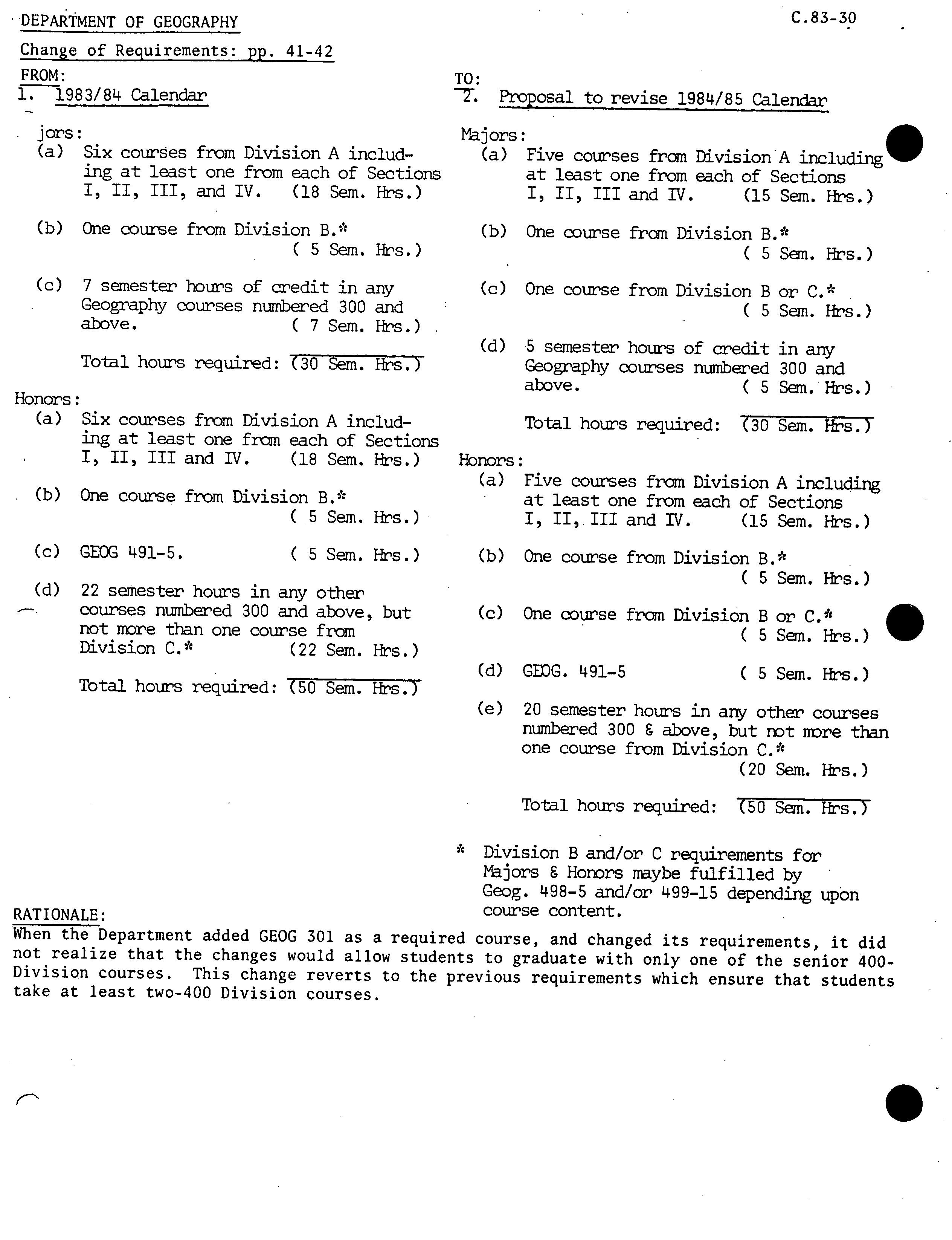
Change of Requirements:
pp.
41-42
FROM:
TO:
1. 1983/84 Calendar
T. Proposal to revise 1984/85 Calendar
jors:
Majors:
(a)
Six courses from Division A includ-
(a) Five courses from Division including
ing at least one from each of Sections
at least one from each of Sections
III, and IV.
(18 Sem. Firs.)
I, II, III and IV.
(15 Sen. Firs.)
(b)
One course from Division B.
(b) One course from Division B.*
(5Sem.Hrs.)
(5 Sm. Hrs.)
(c)
7 semester hours of credit in any
(c) One course from Division B or C.
Geography courses numbered 300 and
( 5 Sen. Hr's.)
above.
C 7 Sem. Firs.)
Total hours required: (30 Sem. Hr's.)
Honors:
(a)
Six courses from Division A includ-
ing at least one from each of Sections
I, II, III and IV.
(18 Sem. Fir's.)
(b)
One course from Division Bi
( 5 Sem. Hr's.)
(c)
GEOG 491-5.
( 5 Sen. Firs.)
(d)
22 semester hours in any other
-
courses numbered 300 and above, but
not more than one course from
Division C.
(22 Sem. Firs.)
Total hours required: (50 Sen. Firs.)
(d) 5 semester hours of credit in any
Geography courses numbered 300 and
above.
( 5 Sen. Hr's.)
Total hours required: (30 Sen. Firs.)
Honors:
(a)
Five courses from Division A including
at least one from each of Sections
I, 11,111 and IV.
(15 Sem. Hr's.)
(b)
One course from Division B.*
( 5 Sen. Hr's.)
(c)
One course from Division B or C.*
( 5 Sen. Firs.)
(d) GEDG. 491-5
( 5 Sem. Hr's.)
(e) 20 semester hours in any other courses
numbered 300 C above, but not riore than
one course from Division C.
(20 Sen. Firs.)
Total hours required: (50 Sem. Hr's.J
* Division B and/or C requirements for
Majors C Honors maybe fulfilled by
Geog. 498-5 and/or 499-15 depending upOn
RATIONALES
course content.
When the Department added GEOG 301 as a required course, and changed
its requirements, it did
not realize that the changes would allow students to graduate with only one of the senior 400-
Division courses. This change reverts to the previous requirements which ensure that students
take at least two-400 Division courses.
S
o
.
.
C.
3-3O
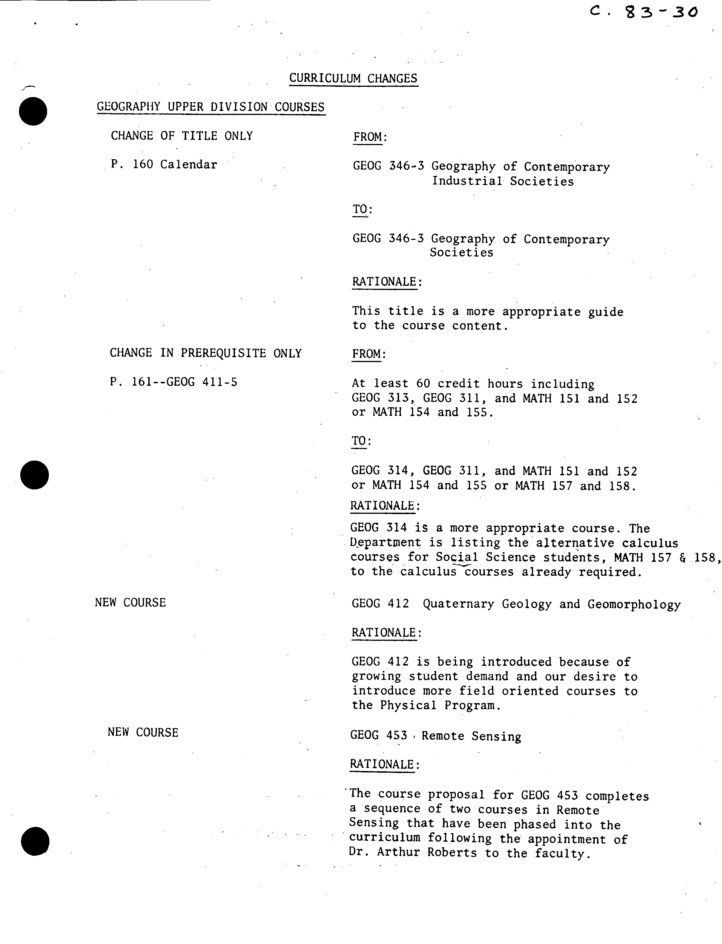
CURRICULUM CHANGES
GEOGRAPHY UPPER DIVISION COURSES
CHANGE OF TITLE ONLY
FROM:
P. 160 Calendar
GEOG 346-3 Geography of Contemporary
Industrial Societies
TO:
GEOG 346-3 Geography of Contemporary
Societies
RATIONALE:
This title is a more appropriate guide
to the course content.
CHANGE IN PREREQUISITE ONLY
FROM:
P. 161--GEOG 411-5
At least 60 credit hours including
GEOG 313, GEOG 311, and MATH 151 and 152
or MATH 154 and 155.
TO:
GEOG 314, GEOG 311, and MATH 151 and 152
or MATH 154 and 155 or MATH 157 and 158.
RATIONALE:
GEOG 314 is a more appropriate course. The
ftepartment is listing the alternative calculus
courses for Social Science students, MATH 157 &J58,
to the calculus courses already required.
NEW COURSE
GEOG 412 Quaternary Geology and Geomorphology
RATIONALE:
GEOG 412 is being introduced because of
growing student demand and our desire to
introduce more field oriented courses to
the Physical Program.
NEW COURSE
GEOG 453 Remote Sensing
RATIONALE:
• The course proposal for GEOG 453 completes
a sequence of two courses in Remote
Sensing that have been phased into the
• curriculum following the appointment of
Dr. Arthur Roberts to the faculty.
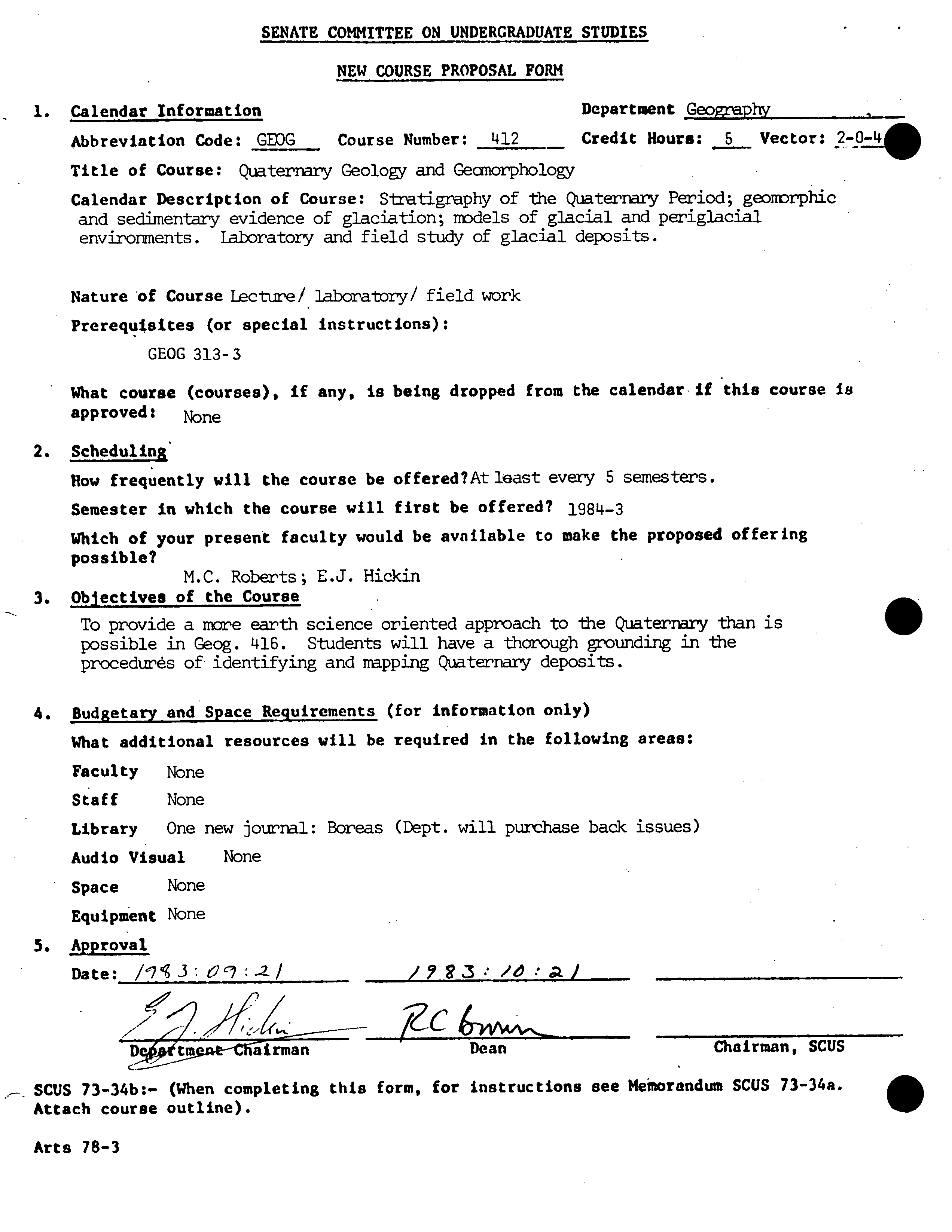
SENATE COMMITTEE ON UNDERGRADUATE STUDIES
NEW COURSE PROPOSAL FORM
1.
Calendar Information
Department
Geography
Abbreviation Code:
GG
Course Number:
412 -
Credit Hours;
5
Vector:
2_O
_=40
Title of Course:
Quaternary Geology and Geaiorpho1o,i
Calendar Description of Course:
S-tatigraphy of the Quaternary Period; geomorphic
and sedimentary evidence of glaciation; models of glacial and periglacial
environments. Laboratory and field study of glacial deposits.
Nature 'of Course
Lecture/ laboratory/ field work
Prerequisites (or special instructions):
GEOG 313-3
What course (courses), if any, is being dropped from the calendar if this course is
approved:
None
2.
Scheduling'
How frequently will the course be of fered?At
least every 5 semesters.
Semester in which the course will first be offered?
1984-3
Which of your present faculty would be available to make the proposed offering
possible?
M.C. Roberts; E.J. Hickin
3.
Objectives of the Course
To provide a more earth science oriented approach to the Quaternary than is
possible in Geog. 416. Students will have a thorough grounding in the
procedures of identifying and mapping Quaternary deposits.
4.
Budgetary and Space Requirements (for information only)
What additional resources will be required in the following areas:
Faculty
None
Staff
None
Library
One new journal: Boreas (Dept. will purchase back issues)
Audio Visual
None
Space
None
Equipment
None
5.
Approval
Date:
/'7'3:O'.2/
/3: ,'O.,)
7ZC
Dt.irire-CTiTirman
Dean
Chairman, SCUS
SCUS 73-34b:- (When completing this form, for instructions see Meiorandum SCUS 73-34a.
Attach course outline).
0
Arts 78-3
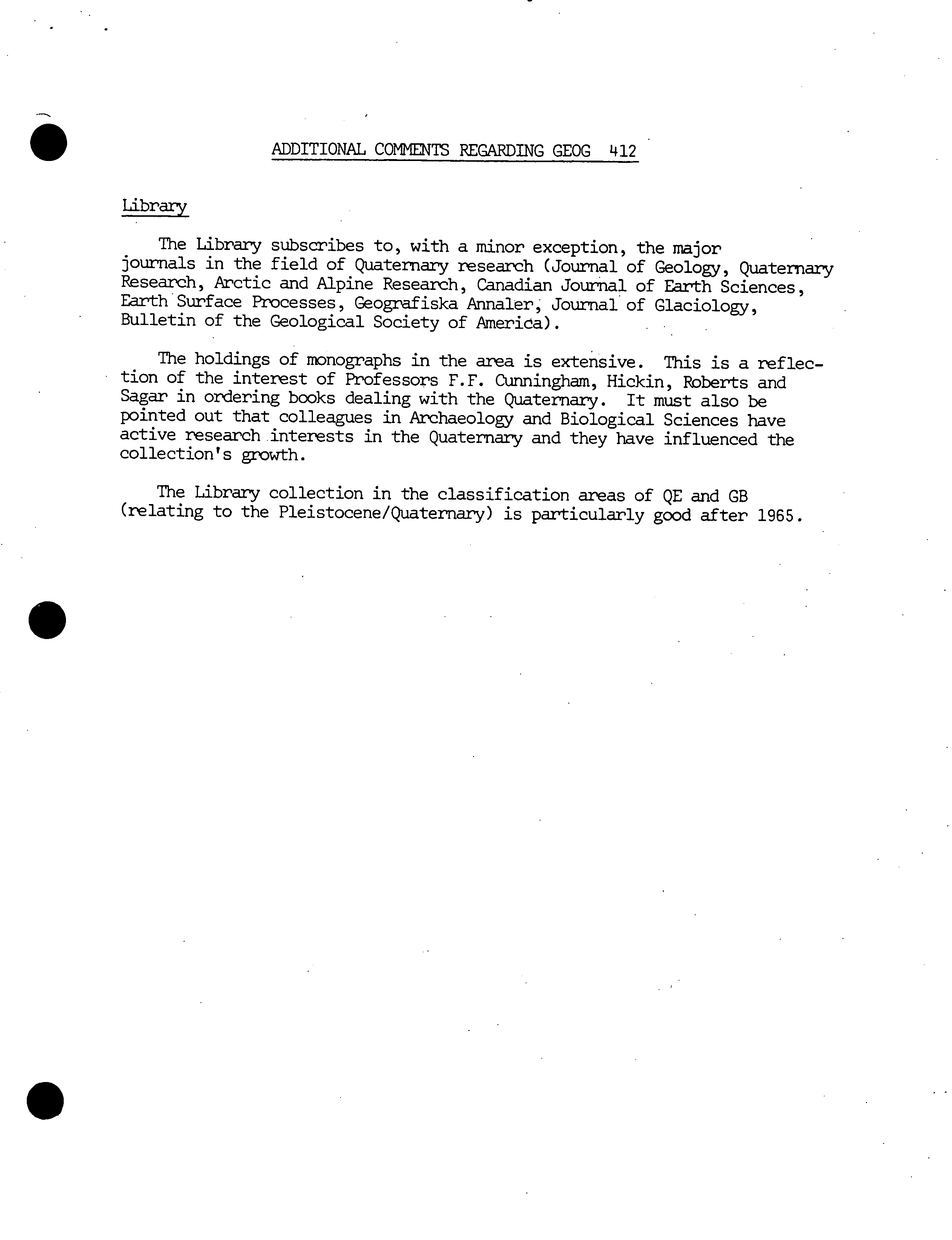
ADDITIONAL COMMENTS REGARDING GEOG 412
Library
The Library subscribes to, with a minor exception, the major
journals in the field of Quaternary research (Journal of Geology, Quaternary
Research, Arctic and Alpine Research, Canadian Journal of Earth Sciences,
Earth Surface Processes, Geografiska Annaler, Journal of Glaciology,
Bulletin of the Geological Society of America).
The holdings of monographs in the area is extensive. This is a reflec-
tion of the interest of Professors F.F. Cunningham, Hickin, Roberts and
Sagar in ordering books dealing with the Quaternary. It must also be
pointed out that colleagues in Archaeology and Biological Sciences have
active research interests in the Quaternary and they have influenced the
collection's growth.
The Library collection in the classification areas of QE and GB
(relating to the Pleistocene/Quaternary) is particularly good after 1965.
S
0
Simon Fraser University
Geography 412
Department of Geography
M.C. Roberts
Course Outline
Quaternary Geology and Geomorphology
This course will examine the stratigraphy, geomorphology, and glacial
depositional models associated with the Quaternary Period. The regional
emphasis will be on Western Canada and adjacent areas in the U.S.
Course Organization: There will be two one-hour lectures per week throughout
the semester, and a three-hour laboratory session. The laboratory session
will be replaced by field trips on at least three afternoons (see schedule).
There will be one weekend field-trip: budget $50 to cover the costs.
Required Text: D.Q. Bowen, 1978, Quaternary Geology; Pergamon.
Course Syllabus:
1.
The Quaternary Period - an overview.
2.
A review of glacial and periglacial geomorphology.
3.
Stratigraphic concepts: stratigraphic procedures for outcrops and
subsurface; concepts unique to the Quaternary; terminology; the
application of the stratigraphic code; correlation; type sections.
4.
Geochronological techniques applicable to the Quaternary.
5.
Quaternary stratigraphy: the evolution of the stratigraphic divisions;
the classical regions-Alps and the Midwest; the impact of marine
evidence.
6.
The Quaternary of B.C. errhasing the record of southwestern British
Columbia.
7.
Models of glacial depositional environments.
8.
Soils in the Quaternary record.
9.
Palynology, tephras, climatic change.
10.
Sea-level changes
Grades: will be determined as follows:
Laboratory and field reports
40%
Mid-term examination
30%
Final examination
30%
Simon Fraser University
Geography 412
]par-bnent of Geography
M. C. Roberts
Quaternary Geology and Geai-iorphology
READING LIST
1bmgraphs
Armstrong, J.E., 1981, Post-Vashon Wisconsin glaciation, Fraser Lowland,
B.C., Geol. Surv. Canada, Bulletin 322.
Birkeland, P.W., 1974, PedolOgy, weathering and geonDrphological research.
Oxford Univ. Press.
Butzer, K.W., 6 Isaac, G.L., (eds.), 1975, After the Australopithecines.
Cullingford, R.A., Davidson, D.A., C Lewin, J. (eds.), 1980, Timescales in
Gecinorphology. J. Wiley and Sons.
Embleton, C., C King, C.A.M., 1975, Glacial geomorphology. (2nd edit.),
Arnold, London.
Flint, R.F., 1971, Glacial and Quaternary Geology, J. Wiley, N.Y.
French, H. M., 1976, The Periglacial Environment. Longman, London.
Goldthwait, R.P., et al (eds), 1971, Till, a symposium. Ohio State Univ. Press.
Hedberg, H.D. (ed), 1976, International Stratigmphic Guide: a guide to
str'atigraphic classification, terminology and procedure. Wiley-Interscienc
New York.
Jopling, A.V. C McDonald, B.C. (eds), 1975, Glaciofluvial and glaciolacus-trine
sedimentation. Special Publication No. 26, S.E.P.M.
Price, R.J., 1973, Glacial and fluvioglacial landfoniis. Hafner, N.Y.
&malley, I.J. (ed.), 1975, Loess: lithology and genesis. Benchmark Papers
in Geology No. 26, Iwden,, Hutchinson C Ross Inc.
Sugden, D.E. C
B.S. John, 1976,
Glaciers and landscape.
London: Edward Arnold.
Turekian, K.K.,
(ed), 1971, The
late Cenozoic glacial ages.
Washburn, A. L., 1973, Periglacial Processes and Environments. Arnold, London.
West, R.G., 1975, Pleistocene geology and biology. Longmen, London.
is
-2 -
Articles
Alley, N.F., 1979, Middle Wisconsin stratigraphy and climatic reconstruction,
southern Vancouver Island, B.C., Quat. Research, 11, pp. 213-237.
Alley, N.F., a Chatwin, S.C., 1979, Late Pleistocene history and geomorphology,
S.W. Vancouver Island, B.C., C.J.E.S., 16,
pp.
1645-1657.
Andrews, J . T. C Ihaffy, M.A .W., 1976, Growth rate of the Laurentide Ice
Sheet and sea level lowering. Quat. Research, 6,
pp.
167-184.
Armstrong, J.E. C Clague, J.J., 1977, Two major lithostrat±graphic units in
S.W., B.C., C.J.E.S., 14, pp. 1471-1480.
Baker, V .R., 1974, Paleohydraulic interpretation of Quaternary alluvium. near
Golden, Colorado. Quat. Research, 4,
pp.
94-112.
Boulton, G. S., 1972, Modern Arctic glaciers as depositional models for
former ice sheets, Jour. Geol. Soc. London, 128,
pp.
361-393.
Chamberlain, T.C., 1895, The classification of American glacial deposits,
Jour. Geology, 3,
pp.
270-277.
Church, M. a Ryder, J., 1972, Paraglacial sedimentation: a consideration
of fluvial processes controlled by glaciation, Bull. Geol. Soc. Amer.,
83,
pp.
3059-3072.
0
Clague, J .J., 1976, Quadra Sand and its relation to the late Wisconsin
glaciation of SW, B.C., C.J.E.S., 13,
pp.
803-815.
Clague, J .J., Armstrong, J . E., a Mathews, W. H., 1980, Advance of the late
Wisconsin Cordilleran Ice Sheet in southern B.C. since 22,000 yr
BP, Quat. Research, 13,
pp.
322-326.
Davis, M. B., 1976, Pleistocene biogeography of temperate deciduous forests.
Geoscience and Man, 13,
pp.
13-26.
Davis, N.F.G., a Mathews, W.H., 1944, Four phases of glaciation with
illustrations from S .W. B.C., Jour. Geology, 52,
pp.
403- 413.
Fasterbrook, D.J., 1969, Pleistocene chronology of the Puget Lowland and
San Juan Islands, Bull. Geol. Soc. Amer., 80,
pp.
2273-2286.
Fairbridge, R .W., 1972, Climatology of a glacial cycle. Quat. Research,
2, pp. 283-302.
Frye, J.C., 1973, Pleistocene succession of the central interior United
States, Quat. Research, 3,
pp.
275-283.
Fulton, R .J., 1965, Silt deposition in late-glacial lakes of southern B.C.,
Amer. Jour. Science, 263,
pp.
553-570.
0
-3-
rl^
[]
Articles cont'd.
Fulton, R. J. C Smith, G.W., 1978, Late Pleistocene stratigraphy of south-
central B.C., C.J.E.S., 15, pp. 971-980.
Heusser, C. J., 1973
5
Environmental sequence foll
o wing the Fraser advance
of the Juan de Fuca lake, Washington, Quat. Research, 3,
pp.
284-306.
Ives, J . D., Andrews, J .
T., C Barry, R .
G., 1975, Growth and decay of the
Laurentide Ice Sheet and
comparisons with Fenno-Scandinavia. Die
Naturwissenschaften, 62, pp. 118-125.
Holtedahl, N., 1967. Notes
on the formation of
fjonds and fjond-valleys.
Geografiska Arinaler 49A: 188-203.
Luci<man, B.H.,
C
Osborn, G.D., 1979, Holocene glacier fluctuations in the
Middle Canadian Rocky Mountains, Quat. Research, 11,
pp.
52-77.
Mthewes, R.W., 1973, A palynological study of postglacial vegetation changes
in the University Research Forest, S.W. B.C., Can. Jour. Botany, 51,
pp.
2085-2103.
Moore, D.P., C Mathews, W.H., 1978, The Rubble Creek Landslide, S.W. B.C.,
C.J.E.S., 15,
pp.
1039-1052.
Morrison, R. B.,
1969,
The Pleistocene-Holocene
boundary. Geologie en
Mijnbouw,
48,
pp.
363-372.
Peacock, M.A. 1935, Fiord-land of British Columbia.
Geological Society of America 46: 636-696.
Bulletin of the
S
Porter, S.C., 1976, Pleistocene glaciation in the southern part of the North
Cascade Range. Bull. Geol. Soc. Amer., 87,
pp.
61-75.
Porter, S.C., C Denton, G .H., 1967, Chronolo
g
y of Neoglaciation in the North
American Cordillera, Amer. Jour. Science, 265,
pp.
177-210.
Roberts, M.C. C Mark, D.M., 1970, The use of trend surfaces in till fabric
analysis, C.J.E.S., 7,
pp.
1179-1184.
Roberts, M.C. 1978, Drainage density variations on the morainic landscapes
of northeastern Indiana. Zeit. Geomorph. 22,
pp.
462-471.
Ruhe, R.V.,
1954, Relations of the properties of Wisconsin
labs to topography
in western Iowa. Amer. Jour. Science, 252,
pp.
663-672.
Sim o
nson, R.W., 1954, Identification and
interpretation of buried soils.
Amer. Jour. Science, 252,
pp.
705-732.
Suggate, R.P., 1965, The definition of "Interglacial". J. Geol., 73,
pp. 619-626.
Tipper, H.W., 1971, Multiple glaciation in central B.C., C.J.E.S., 8,
pp. 743-752.
Articles cont'd.
is
Whright, H.E., 1976, The dynamic nature of Holocene vegetation. Quat.
Research, 6, pp. 581-596.
0
SENATE COMMITTEE ON UNDERGRADUATE STUDIES
NEW COURSE PROPOSAL FORM
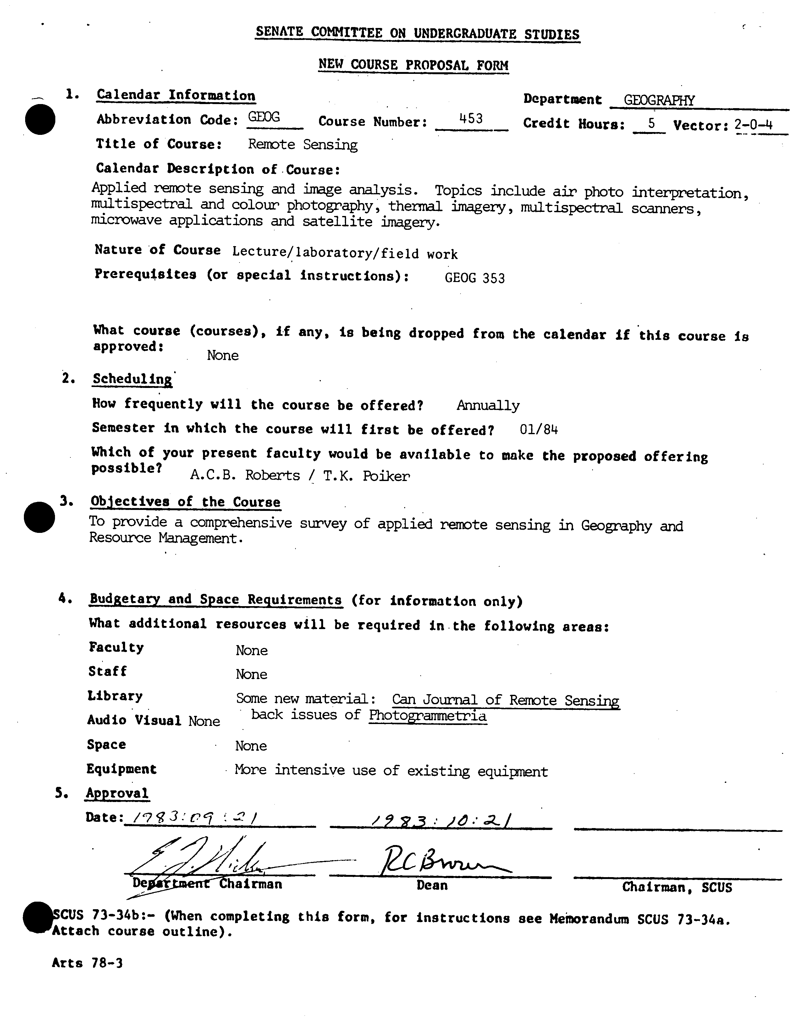
1.
Calendar Information
Department GEOGRAPHY
Abbreviation Code:
GEOG
Course Number:
453 —
Credit Hours:
5
Vector:
204
Title of Course:
Remote Sensing
Calendar Description of Course:
Applied remote sensing and image analysis. Topics include air photo interpretation,
multispectral and colour photography, thermal imagery, multispectral scanners,
microwave applications and satellite imagery.
Nature of Course
Lecture/laboratory/field work
Prerequisites (or special instructions):
GEOG 353
What course (courses), if any, is being dropped from the calendar if this course is
approved:
None
2. Scheduling
How frequently will the course be offered?
Annually
Semester in which the course will first be offered?
01/814
Which of your present faculty would be available to make the proposed offering
possible?
A.C.B. Roberts / T.K. Fbiker
• 3. Objectives of the Course
To provide a comprehensive survey of applied remote sensing in Geography and
Resource Management.
4.
Budgetary and Space Requirements (for information only)
What additional resources will be required in-the following areas:
Faculty
None
Staff
None
Library
Some new material: Can Journal of Remote Sensing
Audio Visual
None
back issues of Photograrmetria
Space
None
Equipment
More intensive use of existing equipment
5.
Approval
_tienrhainnan
Dean
Chairman, SCUS
CUS 73-34b:- (When completing this form, for instructions see Memorandum SCUS 73-34a.
Attach course outline).
Arts 78-3
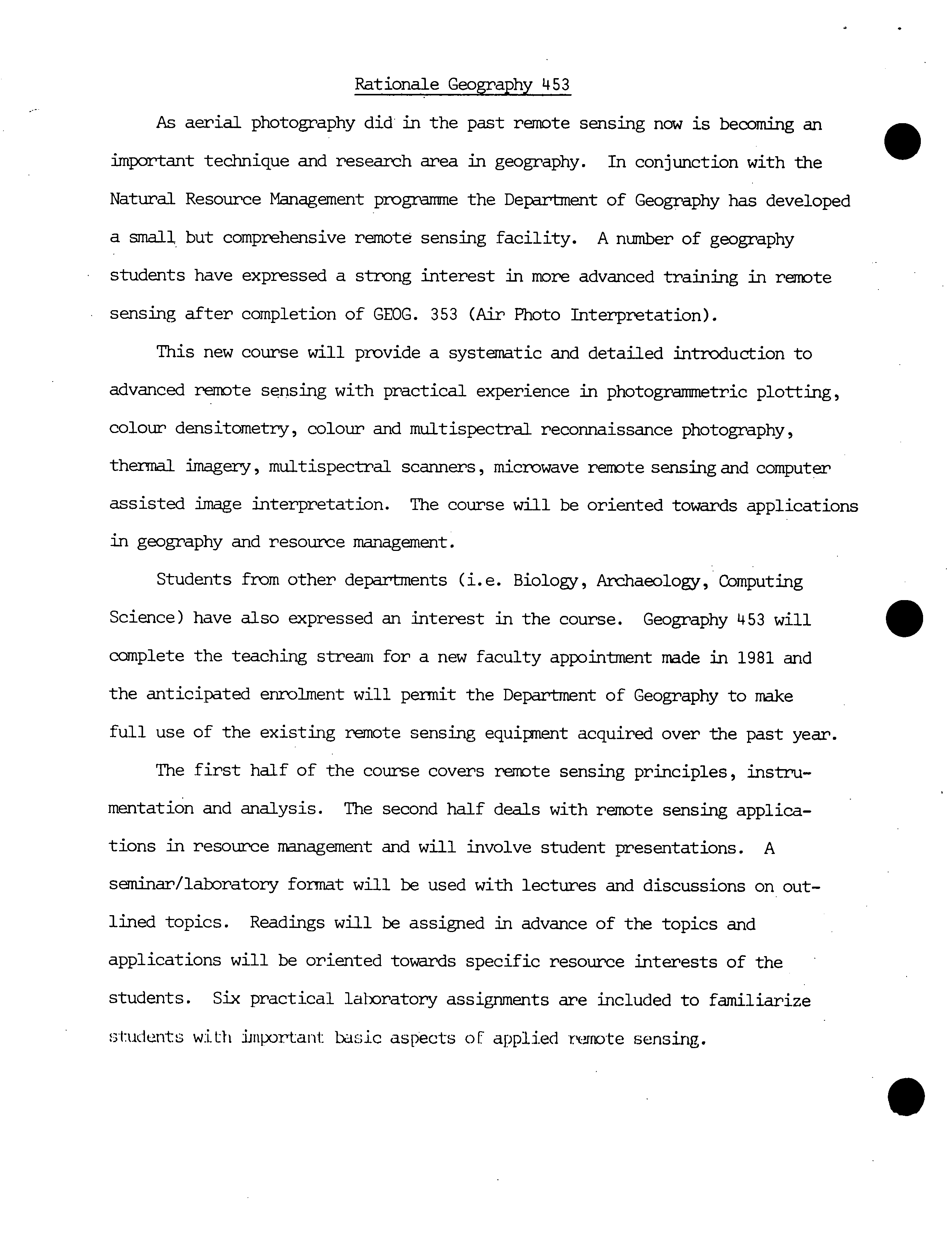
Rationale Geography 453
As aerial photography did in the past remote sensing now is becoming an
important technique and research area in geography. In conjunction with the
Natural Resource Management programme the Department of Geography has developed
a small but comprehensive remote sensing facility. A number of geography
students have expressed a strong interest in more advanced training in remote
sensing after completion of GEOG. 353 (Air Photo Interpretation).
This new course will provide a systematic and detailed introduction to
advanced remote sensing with practical experience in photogranunetric plotting,
colour dens itometry, colour and multispectral reconnaissance photography,
thermal imagery, multispectral scanners, microwave remote sensing and computer
assisted image interpretation. The course will be oriented towards applications
in geography and resource management.
Students from other departments (1. e. Biology, Archaeology, Computing
Science) have also expressed an interest in the course. Geography 453 will
complete the teaching stream for a new faculty appointment made in 1981 and
the anticipated enrolment will permit the Department of Geography to make
full use of the existing remote sensing equipment acquired over the past year.
The first half of the course covers remote sensing principles, instru-
mentation and analysis. The second half deals with remote sensing applica-
tions in resource management and will involve student presentations. A
seminar/laboratory format will be used with lectures and discussions on out-
lined topics. Readings will be assigned in advance of the topics and
applications will be oriented towards specific resource interests of the
students. Six practical laboratory assignments are included to familiarize
students wiLh iJnportai1: basic aspects of applied remote sensing.
L
- 2 -
0
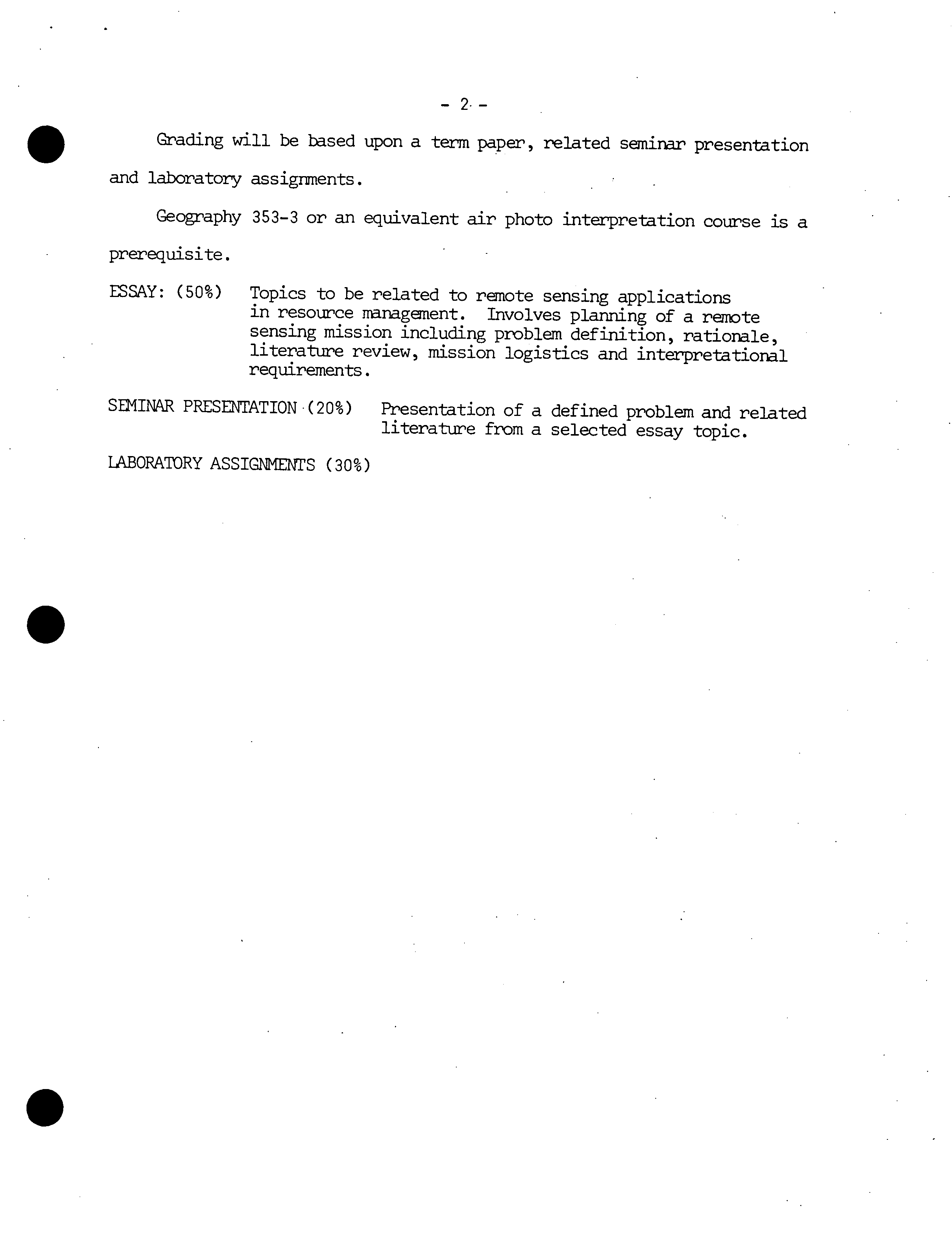
Grading will be based upon a term paper, related seminar presentation
and laboratory assignments.
Geography 353-3 or an equivalent air photo interpretation course is a
prerequisite.
ESSAY: (50%) Topics to be related to remote sensing applications
in resource management. Involves planning of a remote
sensing mission including problem definition, rationale,
literature review, mission logistics and interpretational
requirements.
SEMINAR PRESENTATION '(20%) Presentation of a defined problem and related
literature from a selected essay topic.
LABORATORY ASSIGNMENTS (30%)
.
S
-3-
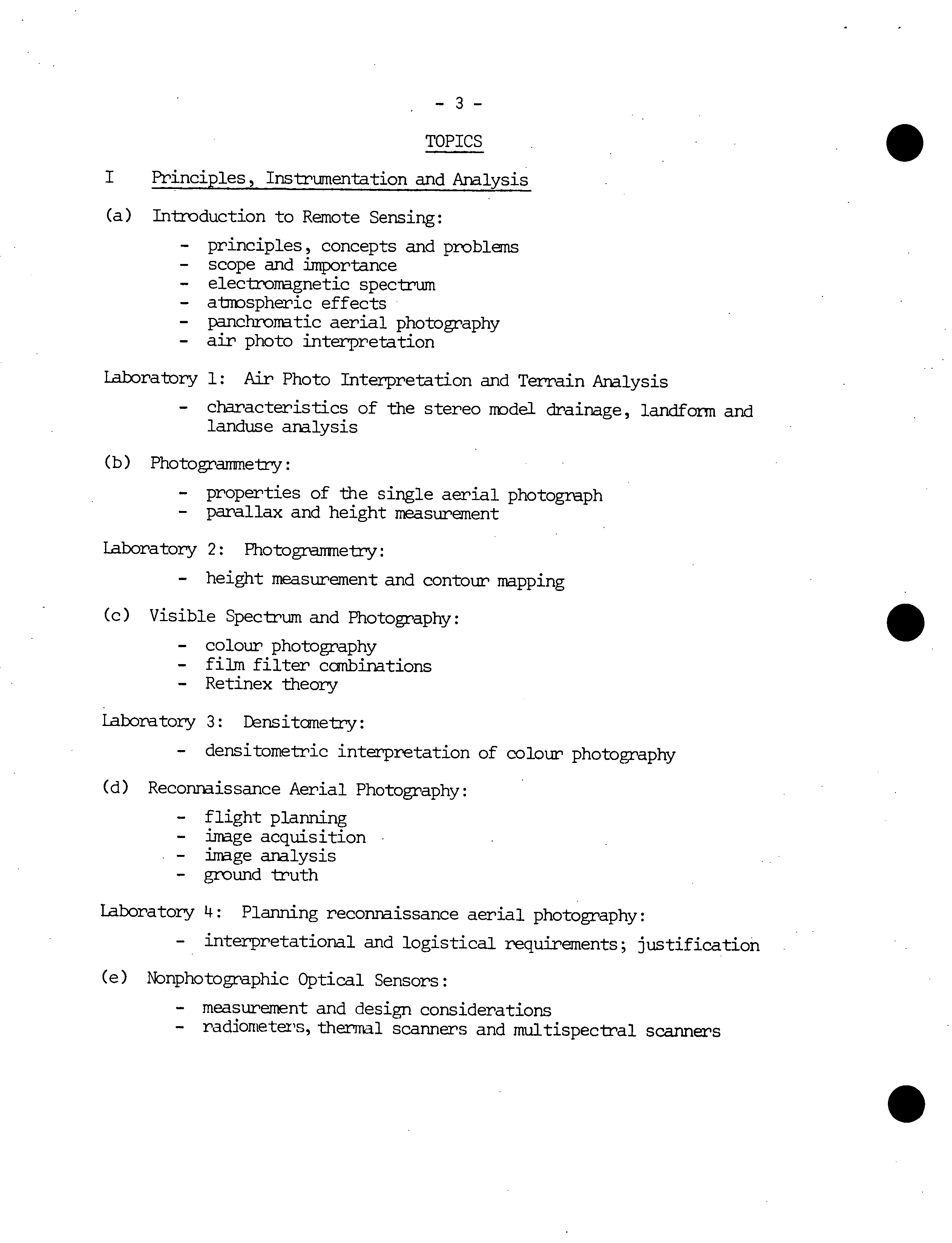
TOPICS
Principles, Instrumentation and Analysis
(a)
Introduction to Remote Sensing:
- principles, concepts and problems
- scope and importance
- electromagnetic spectrum
- atmospheric effects
- panchromatic aerial photography
- air photo interpretation
Laboratory 1: Air Photo Interpretation and Terrain Analysis
- characteristics of the stereo model drainage, landform and
landuse analysis
(b) Photogranmetry:
- properties of the single aerial photograph
- parallax and height measurement
Laboratory 2: Photogrenrne-b'y:
- height measurement and contour mapping
(c)
Visible Spectrum and Photography:
- colour photography
- film filter combinations
- Retinex theory
Laboratory 3: Lnsitanetry:
- densitometric interpretation of colour photography
(d)
Reconnaissance Aerial Photography:
- flight planning
- image acquisition
- image analysis
- ground truth
Laboratory 4: Planning reconnaissance aerial photography:
- interpretational and logistical requirements; justification
(e)
Nonphotographic Optical Sensors:
- measurement and design considerations
- radiometers, thermal scanners and multispectral scanners
0
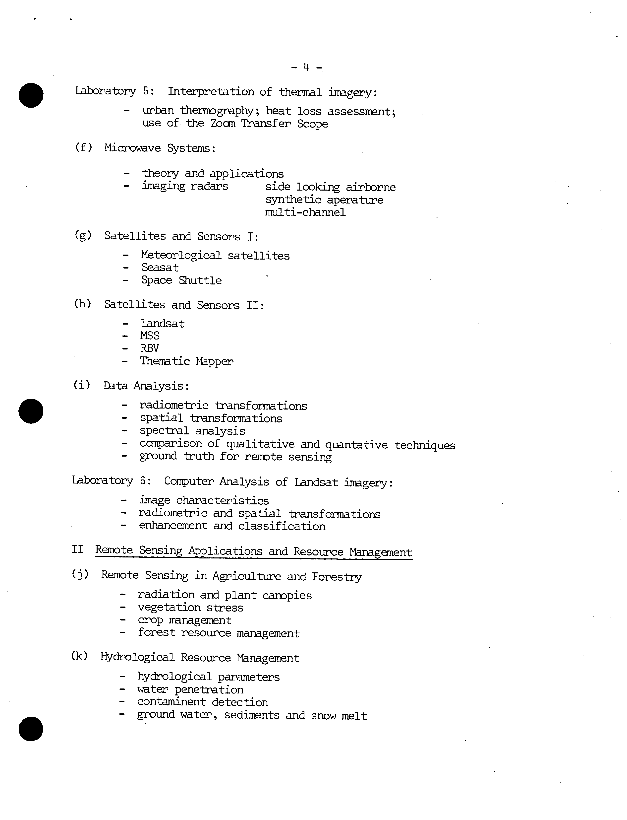
-If-
.Laboratory 5: Interpretation of thermal imagery:
-
urban thernDgraphy; heat loss assessment;
use of the Zoan Transfer Scope
(f) Microwave Systems:
- theory and applications
- imaging radars
side looking airborne
synthetic aperature
multi-channel
(g)
Satellites and Sensors I:
- Meteorlogical satellites
- Seasat
- Space Shuttle
(h)
Satellites and Sensors II:
- Landsat
- MSS
- RBV
- Thematic Mapper
(i)
Data Analysis:
.
- radiometric transformations
- spatial transformations
- spectral analysis
- cci'nparison of qualitative and quaritative techniques
- ground truth for remote sensing
Laboratory 6: Computer Analysis of Landsat imagery:
- image characteristics
- radiometric and spatial transformations
- enhancement and classification
II Remote Sensing Applications and Resource Management
(j)
Remote Sensing in Agriculture and Forestry
- radiation and plant canopies
- vegetation stress
- crop management
- forest resource management
(k)
Hydrological Resource Management
- hydrological parameters
- water penetration
- contaminent detection
- ground water, sediments and snow melt
-5-
(1) Geological Applications:
- photo-geology
- surficial mapping
- radar imagery
- multi-spectral techniques
(m) Terrain Analysis and Cultural Applications
- multispectral techniques
- photo interpretation
spatial analysis and classification
- site mapping
.
.
0
•
..
.•
•.
;
LWZ
Lille.ád, T.M.end
R.W.
g ie.fer
ibt
Sensing end tmge Inter-
pretauon, John Wiley & Sons, Toronto, 1979
.1
.
•
..
• G
SOURS °.
Aird, W.J. and S.P. Pierce, 1976
:
Reiote Sensing
Data summus Ottawa,
Environmental
Conservation Directorate, Enviruamantal Protection
Service, Environment
Canada,
5u. .
Caiadián. Advisory Comeitte.
Reports on Remote Seneing, Energy, )Unes and
Resources, Ottawa, 1978 -
Canadian Journal of Remote Sensing Ottawa,
Canadian Aeronautics
and Space
Institute, 1975 -
.
Cihier,
J. CCRS Airborne Program Assessment:
2v. Analysis and User.Beporte
Energy Nines and
Resources, Ottawa, 1978e
Glen, J.W., R.J. Adis and D.M. Johnson (ads.) 1975 "Synçosiun on remote
sowing in glaciology". Journal of
Glaciol4
y ,
Vol. 15, no. 73, pp.
1-482.
IEEE Transactions on Geosciencte and Remote Sensing, New York, Institute
of Electrical and Electronic Engineers
•
Kogan, R.M., I.M.'Nazarov and S.D. Fridman, 1971 Gai.ns Spectrometry of
• . Natural Environments and Formations: Theory of the Method Applica-
tions to Geology and Geophysics, Available from the U.S. Dept. of
Corce, National Technical Information Service,
Springfield
Lints, J. and D.S. Siacnatt, 1976 '
Rete
Sensing of Environment,
Addison-
Wesley ,
Publishing Company, Don
Mills,
Ontario
lauder, D.L, 1959 Aerial Photographid 'Int.rpratation i
'and
,
Application, McGraw-Hill,
Na
y
York
'U
Meier, LP.1979 "Remote Sensing of Snow and Ice" Technical Papers In
Rdrology,
No, 19,' UNESCO
'Pho*egrasmetria, Elsevier,
Amsterdam
Photo
g
ratrjc 'Engineering
,
and 'Remote Sensing American Society of Photo-
graistry, Falls Church
Proceedings of 'the 'First to Fourteenth
International Syo.ia on
Remote
ein g
of
Institute. of -chigan,-
-
Ann Arbor
Reeves, E.G.,
A. Anson and D. Landen (ede.), 1975 'Manual of Remote Sensing
American Society of Photograinmetry, Falls Church
Remote Sensing in Canada C.C.R.S., Energy Mines and Resources, Ottawa
V. 1 - V. 8
Science, American Association for the Advancement of Science, Washington,
D.C.
Slams, C.C., C. Theurer and S.W. Henriksen, 1980 Manual of Photogratry,
Fourth Edition, American Society of Photogramsetry, Falls Church
Smith, J.T. Sr. (ad.), 1968 Manual of Color Aerial Photography, American
Society of Photograimnetry, Falls Church
Thompson, G.E. (ed.) 1974
"The Applications
of
Remote Sensing and Benefits
to
Canada"
Proceedings
of
the Second
Canadian S
y
m p
osium on Remote
Sensingg Energy, Mines
and
Resources,
Ottawa
Thompson, G.E. (ed.) 1975 Third Canadian S
yp
osium on Remote 'Sensing,
Canadian Aeronautics and Space Institute, Ottawa
Thomson, K.P.B. (ad.) 1977' 4th Canadian Symposium on Remote 'Sensing,
Canadian Aeronautics and Space Instttue, Ottawa
Vesiroglu, T.N.(ed.) 1975 Remote -Sensing: Energy Related'' Studies,
John Wiley & Sons, Toronto
A
Vt,, DJ., 1973
TSrrAft M
.l
y s j
s: •
AOuids
to site
SslSction Using Aerial
I
Photo g
raphic Intsr
p
r.titjcn, DovdSu, .Uiatchinson and Roar Inc.,
$trsud.burg,
Pennsylvania
Vendsroth, 8.
and K. Yost, 1975 Muleis
p
.ctralPhotograpay Science
Reginesring
Research Group, C.W. Poet Canter, Long Island University,
$svYork
-
Whit4
o,
1972
"Resource Satellites and Remote
Mrboe
Sensing
For Canada", Proceedings of the
First
Canadian Symposium on Remote
!a
'
Energy Mines and Resources, Ottawa
Zeilinazky, V.G., 1966 Photographic Interpretation of Tree Species in
Ontario,
Ontario, Department of Lands and Forests, Queen's Park,
Toronto
0